GIS-Powered Field Operations Platform
Run Your Entire Field Operation From One Map
Replace spreadsheets, paper forms, and disconnected tools with one platform to capture, track, and report field data in real time.
Built for teams that need better visibility across field operations.
Faster Data Capture
10x
Standardised Workflows
100%
Manual Reporting
0
Live Field Visibility
Structured Data Capture
Instant Reporting
The Problem
Field Operations Are Still Held Together by Spreadsheets
Most field teams are still relying on a mix of paper forms, Excel files, and disconnected apps. That leads to delayed reporting, inconsistent data, and limited visibility across the job.
No real-time visibility
Disconnected systems
Lost or inconsistent data
Too much manual admin
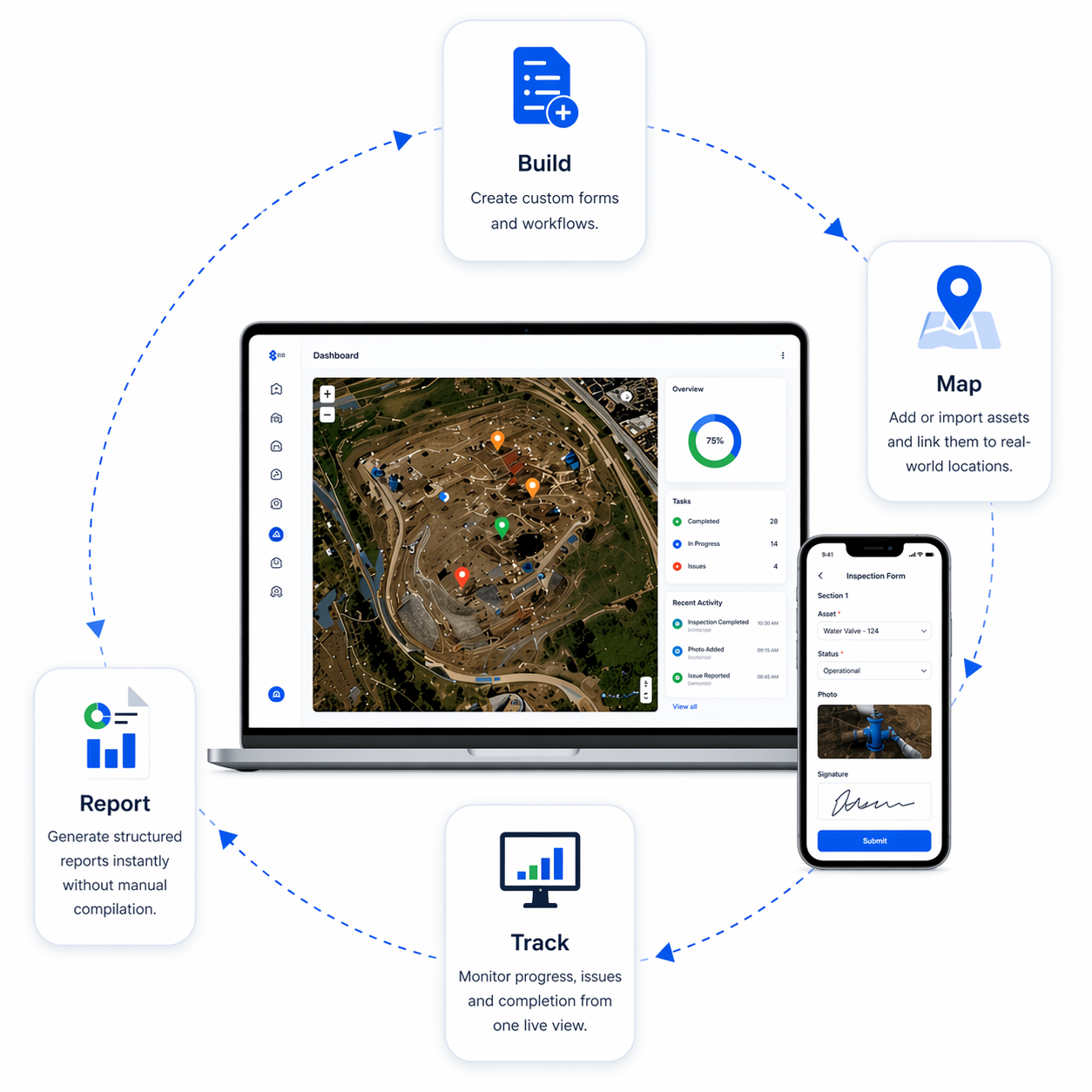
How It Works
Built to Run Field Workflows End to End
Build
Create custom forms and workflows for inspections, audits, and tracking.
Map
Add or import assets and link them directly to real-world locations.
Capture
Collect field data on mobile, including offline when needed.
Track
Monitor progress, issues, and completion from one live view.
Report
Generate structured reports instantly without manual compilation.
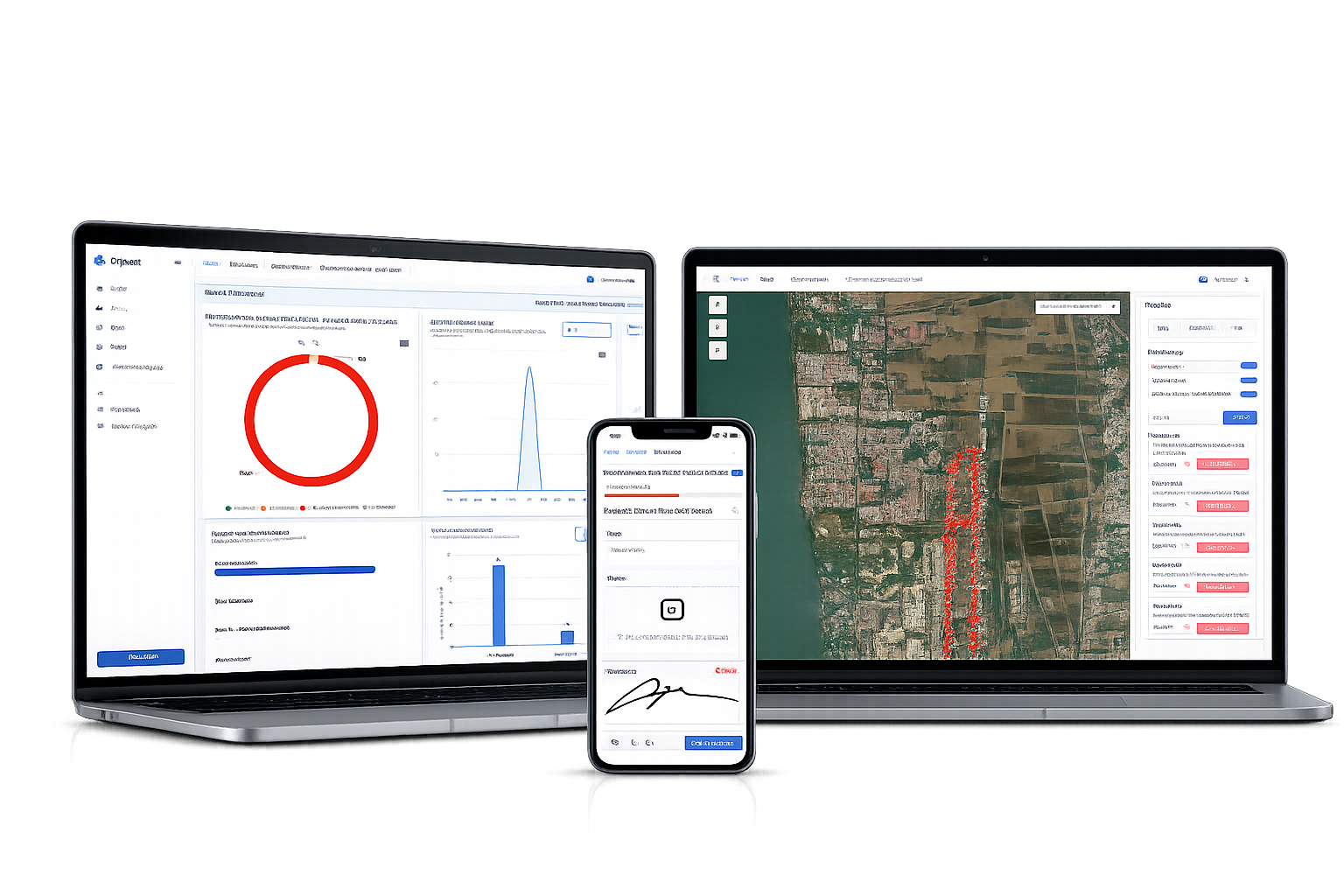
One System. Full Visibility.
Oriyent brings your entire field workflow into a single, map-based platform so every task, asset, and data point is structured, trackable, and instantly accessible.
Faster Reporting
Eliminate manual report writing and generate structured outputs directly from the field data you collect.
Real-Time Visibility
See what is happening on-site as work is completed, updated, and synced across your team.
Reduced Errors
Use standardised forms and structured workflows to reduce rework and improve consistency.
Offline Capability
Keep working in the field without signal and sync automatically when you are back online.
Simplified Stack
Replace multiple disconnected tools with one platform built for spatial field operations.
Location-Based Control
Connect forms, assets, and tasks to real-world locations so you can manage work visually.
Platform Overview
More Than Forms. A Spatial System for Field Work.
Most tools focus on collecting data. Oriyent connects your data to location so you get a complete, real-time view of your operations.

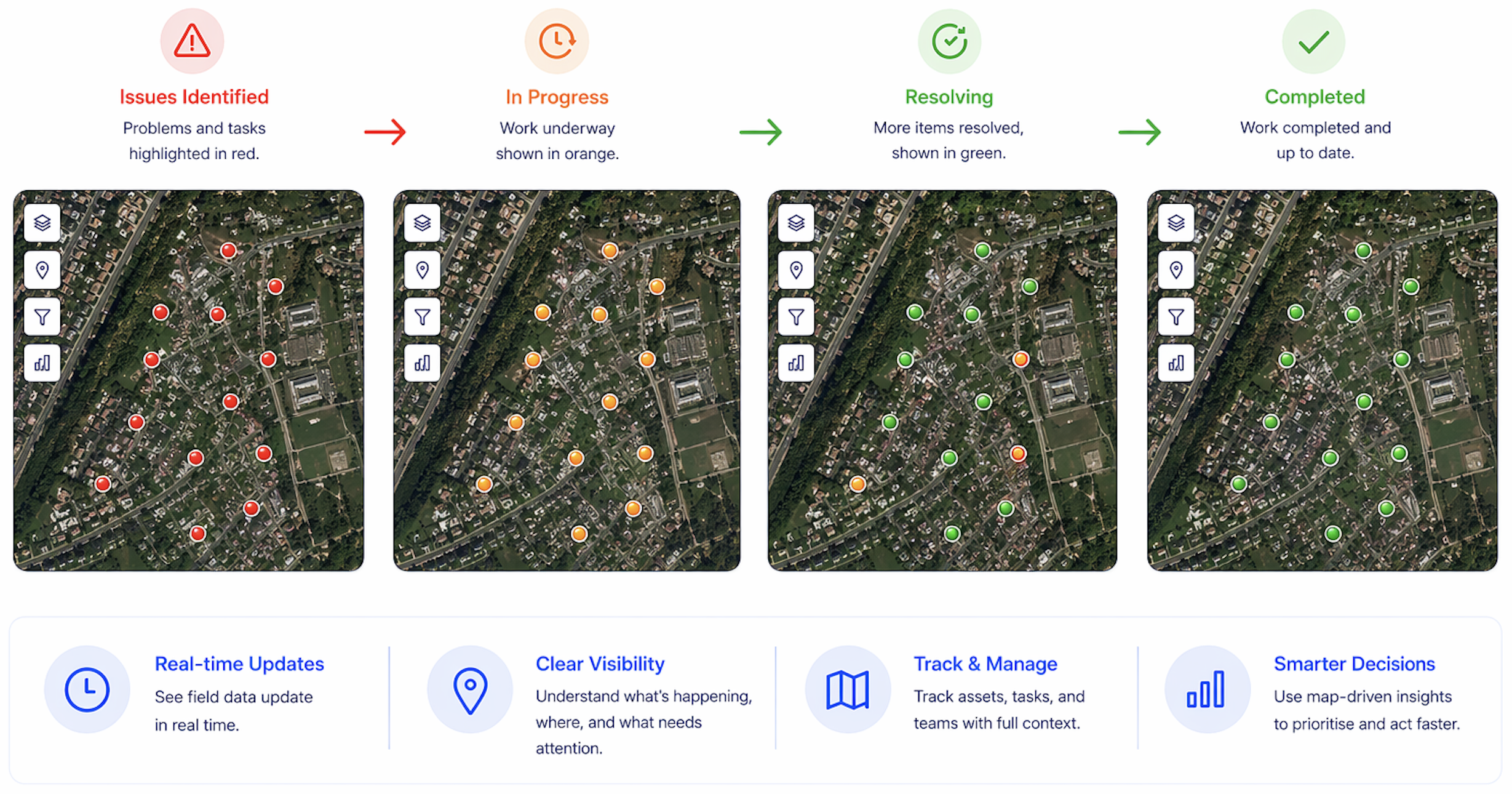
Interactive GIS Mapping
View, manage, and update field data directly on the map so your team can understand what is happening, where it is happening, and what needs attention next.
- Real-time location-based data visibility
- Clear asset and task tracking
- Map-driven workflows for field teams
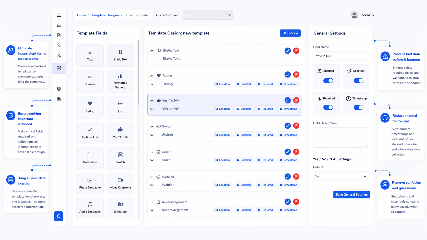
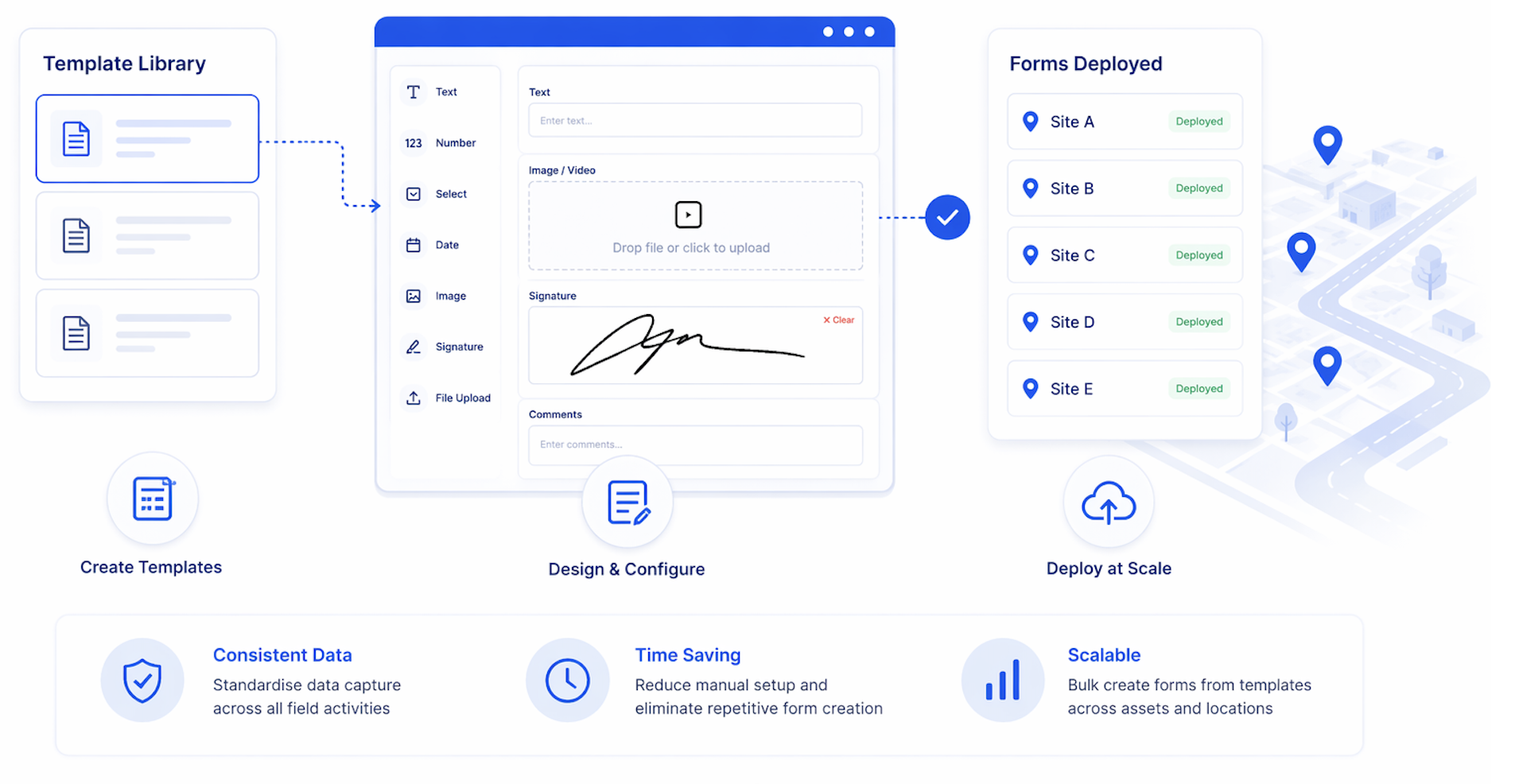
Template Designer & Management
Design flexible templates for inspections, audits, and workflows, then use them to generate forms at scale across assets and locations. Ensure every team member captures data consistently, every time.
- Custom fields, validation, and logic
- Support for photos, signatures, and attachments
- Offline form completion and sync
Advanced Form Builder
Create and deploy forms at scale by generating them directly from templates for each asset or location. Standardise data capture across your entire project without manually building forms one by one.
- Bulk create forms from templates across assets and locations
- Ensure consistent data capture across all field activities
- Reduce manual setup and eliminate repetitive form creation
Built for Your Industry
Specialized solutions for diverse field operations
Construction
Site inspections, quality control, and progress tracking
• Safety checklists
• Progress photos
Infrastructure
Asset management and maintenance workflows
• Asset tracking
• Maintenance logs
Utilities
Network monitoring and service documentation
• Grid monitoring
• Service reports
Environmental
Environmental monitoring and compliance reporting
• Impact assessments
• Compliance tracking
Built for teams that need better visibility, less admin, and a simpler way to manage field operations.
Simple, Transparent Pricing
Choose the plan that fits your team and grow as your field operations scale.
Coming Soon
Team (Mobile-Only Access)
Essential mobile access features
$19
/month
30 days free trial
Access forms on mobile
Complete & submit forms
View and interact with GIS maps
Scan QR codes to access linked data
Work offline and sync data
Switch between multiple projects
View template previews
Import Asset/Data Registers from CSV
Create/edit templates
Assign templates to map/data
Create new forms, data, and groups
Bulk assign or complete via map groups
CAD/KML import and advanced GIS tools
Custom workflows and automation
Priority support & onboarding
Most Popular
Creator (Web + Field Access)
Full web and field capabilities
$35.0
/month
30 days free trial
Access forms on mobile
Complete & submit forms
View and interact with GIS maps
Scan QR codes to access linked data
Work offline and sync data
Switch between multiple projects
View template previews
Import Asset/Data Registers from CSV
Create/edit templates
Assign templates to map/data
Create new forms, data, and groups
Bulk assign or complete via map groups
CAD/KML import and advanced GIS tools
Custom workflows and automation
Priority support & onboarding
Enterprise Custom
Tailored solutions for large-scale operations
POA
/month
30 days free trial
Access forms on mobile
Complete & submit forms
View and interact with GIS maps
Scan QR codes to access linked data
Work offline and sync data
Switch between multiple projects
View template previews
Import Asset/Data Registers from CSV
Create/edit templates
Assign templates to map/data
Create new forms, data, and groups
Bulk assign or complete via map groups
CAD/KML import and advanced GIS tools
Custom workflows and automation
Priority support & onboarding
Stop Guessing What’s Happening in the Field
Get a clear, real-time view of your operations without the admin overhead.